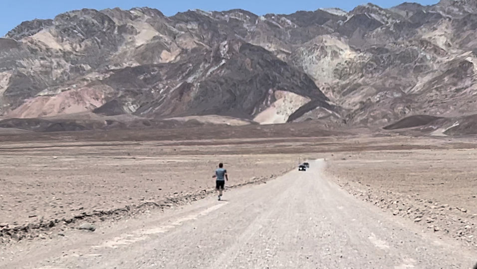
Right Off the Highway Runs & Hikes
*This is Death Valley NP and is nowhere near a highway
West Virginia
I-64
Grandview National Park, Exit 129, near Beckley
I believe there is no usage fee.
This is a five star off the highway trail system. It's five minutes off the highway, there are miles of trails that start in the main parking lot. The trails are various levels of difficulty. The Rim Trail is moderate with about 3.6 miles out and back and fantastic views. Castle Rock is beautiful, but not for the feint of heart. Woodland and Big Buck are by Shelter 2, and can be combined for a nice 1.5ish mile figure eight. There is some mountain biking. There's a playground, so you can let your husband watch the kids while you run. There are picnic shelters, water, and bathrooms. If you turn the other way off the exit there is a handy gas station and a restaurant.
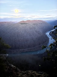
Grandview Full Moon Hike
Little Creek Park, South Charleston, Exit 53 eastbound, 54 or 53 west.
Free
Five or so minutes off the highway. Lots of trails, but not always well marked. Mostly moderate, but almost all up and down. Park in the very first ball field parking lot and you access the trails. Drive all the way to the back of the park for the Devil’s Tea Table loop trail. Interesting geological feature. There is also a nice disc golf course. Mountain Biking as well.
Meek’s Mountain, Hurricane, Exit 39,City Park, Hurricane, WV (pronounced Her-uh-kin)
Free
Miles of trails, mostly hilly. Less than 15 minutes off the highway. Mountain biking as well.
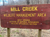
Mill Creek Wildlife Management Area, Exit 28, Milton
This place was a happy find, but it is not simple to find. Go north off the exit about 4-5 miles. If you go into Mason County you have gone too far. Apple Maps, Google Maps and the link
I have included tell you to stay on Johns Creek Rd, but you have to turn left on Bedford Chapel Rd. Keep an eye out for Bedford Chapel Rd, which veers left. There's a big yellow and black arrow sign beside the Bedford Rd sign. Follow Bedford about .3 miles to a gravel road that kind looks like a driveway, but it isn't. Turn left on the gravel road and follow that about a mile to a big gravel parking lot. We hiked west on a dirt road through a very pretty valley/field that follows the creek. There is not supposed to be any motorized vehicles in the park. It is a nice flat hike for about the first 1.5 miles. We turned around after that. One piece of litter. Keep it that way. We were the only people there, but it might be busier during hunting seasons.
There is no trail map but there is this: Park Map


Watch for this intersection! Turn left here.
I-64/77
Kanawha River Running, Biking Walking Trail along the Kanawha River
Free
Almost any exit for downtown Charleston will get you about 9 miles of paved trail along the river, if you do the whole thing. It's pretty flat and right off the highway. Just look for the river.
New River Gorge National Park, Exit 48 Fayetteville, WV
No fee last time I checked. It might be 20 minutes, but it is worth it. There are about 100 miles of trails in America's newest national park. I can't detail them all, but the Endless Wall Trail is a favorite. Long Point gives a great view of the bridge and gorge. Some of the trails are right around the New River Gorge Bridge and Visitors Center, some are further afield. I have hiked a bunch of them and haven't been disappointed yet.
Trail Map This page provides trails by regions of the park. The Fayetteville Area section is the area near the Visitors Center.
I-68
Cooper's Rock St. Park, Exit 13, right off the highway nearish Maryland border.
Most, if not all, of WV State Parks and forests are free.
"Established in 1936, Coopers Rock State Forest boasts some of the most iconic views in Almost Heaven. Located just off I-68, about 13 miles from Morgantown, the park features canyon overlooks, historical sites, picnic shelters, 50 miles of hiking and biking trails, sandstone cliffs for climbing and bouldering, cross-country ski terrain, a lake perfect for reeling in trout and a nearby river for rafting." from their webpage.
Trail Map is a photo or must be downloaded from their website.
I-77
Nothing yet...
I-79
Stonewall Resort St. Park, Exit 91, near Weston.
Most, if not all, of WV State Parks and forests are free.
Maybe ten minutes off the highway. Several pretty easy trails, but remember it's WV so there is going to be some up and down. About 13 miles of trails in all. A very nice trail that follows the lake shore, but doesn't go all the way around. It's a big lake.
Trail map has to be downloaded from their website.
Coonskin Park, Kanawha County Parks, Charleston, Exit 1
Free
Three minutes off the highway in Charleston, miles of trails from rail trail along the river to nice climbs. The Grotto, or Alice Knight Trail is quick, tricky, and pretty, with a rocky path. The airport is talking about acquiring the back portion of this park and filling it in to extend the runway, so it might not be open forever. Great park if you like airplanes. It’s on the landing/take off path for the airport. Rail trail is partly paved, part gravel, part dirt along the Elk River. Mountain biking and limited disc golf as well.
Trail Map is a photo or must be downloaded from their website.
I-81
US-19
New River Gorge National Park, Fayetteville, WV
No fee last time I checked. There are about 100 miles of trails in America's newest national park. I can't detail them all, but the Endless Wall Trail is a favorite. Long Point gives a great view of the bridge and gorge. Some of the trails are right around the New River Gorge Bridge and Visitor Center, some are further afield. I have hiked a bunch of them and haven't been disappointed yet.
Trail Map This page provides trails by regions of the park. The Fayetteville Area section is the area near the Visitors Center.